What can aerial drone mapping do for you? The easier question is what can’t it do! In doing research for this article, I ran across a wide variety of applications and enough information to make my head spin. I will try to break it down to the basics then more future articles with more detail.
Applications
- Real Estate & Construction: Planning, Marketing, Progress
- Nature Conservancy: Water Sheds, Preserves, Wetlands
- Agriculture
- Surveying
- Inspections: Bridges, Roofs & Equipment, Infrastructure
- Security Planning: View areas of shadow and plan for camera placement
- Accident Reconstruction
Why Drones?
Unmanned Aerial Systems (UAS), are cost and fuel effective, easier on the environment, and require less overhead and administration than operating larger manned aircraft.
“Unmanned Aerial Systems (UAS), are cost and fuel effective, easier on the environment, and require less overhead and administration”
The Mission
Global Positioning System (GPS) waypoints are set prior to the mission and can be recalled and used for future missions, ensuring that the drone is capturing the same area every time. This is especially helpful when monitoring a construction site, nature area, water shed, or progress of an agricultural crop just to name a few.
The UAS camera is pointed straight down and the software used for mapping, will fly the mission on its’ own. Hundreds to thousands of photos will be taken.
Processing & Views
After the mission, the photos will be uploaded to one of numerous programs available for mapping. They will be “stitched” together to form a cohesive picture that can be viewed in a variety of ways. This is called an orthomosaic. There are cell phone apps that allow you to take this orthomosaic into the field so you can find the features you marked on the map during analysis. A couple of applications are locating and eliminating noxious weeds or marking property boundaries.
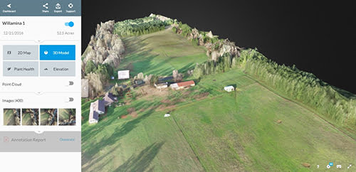
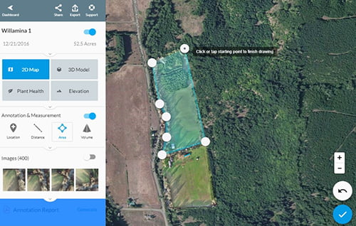
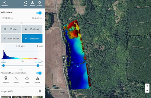
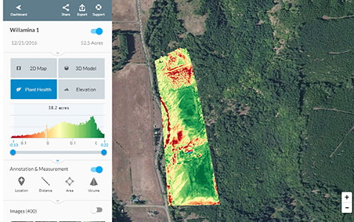
The software used by Salem Aerial, for example, allows you to view 2D, 3D, Plant Health, & Elevation.

Drone Mapping Software
Basic Features
- Measure distance and it will also show you the elevation as you move along the path you drew.
- Select an area to find out the number of acres.
- Select an area that includes width and height to find volume.
- Perimeter Calculations.
- Annotate all of these on the map and then generate a report showing your measurements.

Advanced Features
- Point Cloud for 3D modeling, measuring, and triangulation
- Contour Maps to show elevation
- GIS (Geographic Information System) Layers – Showing different types of geographic or plant data in each layer
- Agriculture: Searching for a specific weed color to identify locations, for example.
- And so much more!

